George M. Bryan Airport
George M. Bryan Airport (former Starkville AF Aux. Field) | |||||||||||
|---|---|---|---|---|---|---|---|---|---|---|---|
 USGS 2006 orthophoto | |||||||||||
| Summary | |||||||||||
| Airport type | Public | ||||||||||
| Owner | City of Starkville | ||||||||||
| Serves | Starkville, Mississippi | ||||||||||
| Elevation AMSL | 333 ft / 101 m | ||||||||||
| Coordinates | 33°25′59″N 088°50′55″W / 33.43306°N 88.84861°W | ||||||||||
| Map | |||||||||||
 | |||||||||||
| Runways | |||||||||||
| |||||||||||
| Statistics (2023) | |||||||||||
| |||||||||||
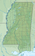
George M. Bryan Airport[1][2] (ICAO: KSTF, FAA LID: STF) is a public use airport in Oktibbeha County, Mississippi, United States.[1] It is owned by the City of Starkville and located three nautical miles (6 km) southwest of its central business district.[1] This airport is included in the National Plan of Integrated Airport Systems for 2011–2015, which categorized it as a general aviation facility.[3]
Also known as Starkville / Oktibbeha County Airport or George M. Bryan Field,[4] the airport was named in honor of World War II veteran and Starkville native George Martin Bryan.[5]
Although many U.S. airports use the same three-letter location identifier for the FAA and IATA, this airport is assigned STF by the FAA[1] but has no designation from the IATA[6] (which assigned STF to Stephens Island in Queensland, Australia).[7]
History
[edit]Opened in 1934 as Starkville Municipal Airport. During World War II the airport was taken over abruptly by the government to be used as a glider training base (Starkville AF Auxiliary Field). Plans for the AAF Basic Training Detachment were for 150 students using the Aeronca TG-5 gliders. The gliders were towed by Vultee BT-13 Valiant "Vultee Vibrators". Students lived in the dormitories at Mississippi State College, where they also used its classrooms and dining facilities. [8]
Facilities and aircraft
[edit]George M. Bryan Airport covers an area of 635 acres (257 ha) at an elevation of 333 feet (101 m) above mean sea level. It has one runway designated 18/36 with an asphalt and concrete surface measuring 5,550 by 150 feet (1,692 x 46 m).[1]
For the 12-month period ending February 17, 2023, the airport had 31,237 aircraft operations, an average of 86 per day: 98% general aviation and 2% military. At that time there were 52 aircraft based at this airport: 41 single-engine, 7 glider, 2 jet, and 2 multi-engine.[1]
See also
[edit]References
[edit]- ^ a b c d e f g FAA Airport Form 5010 for STF PDF. Federal Aviation Administration. Effective November 30, 2023.
- ^ "George M. Bryan Airport". Oktibbeha County. Retrieved August 14, 2013.
- ^ "2011–2015 NPIAS Report, Appendix A" (PDF). National Plan of Integrated Airport Systems. Federal Aviation Administration. October 4, 2010. Archived from the original (PDF, 2.03 MB) on September 27, 2012.
- ^ "Starkville / Oktibbeha County Airport". City of Starkville. Retrieved August 14, 2013.
- ^ "George M. Bryan Field". Raspet Flight Research Laboratory. Archived from the original on April 30, 2008.
- ^ "George M. Bryan Airport (IATA: none, ICAO: KSTF, FAA: STF)". Great Circle Mapper. Retrieved August 14, 2013.
- ^ "IATA Airport Code Search (STF: Stephens Island)". International Air Transport Association. Retrieved August 14, 2013.
- ^
 This article incorporates public domain material from the Air Force Historical Research Agency
External links
[edit]- George M. Bryan Airport at Oktibbeha County website
- Starkville / Oktibbeha County Airport at City of Starkville website
- Aerial image as of March 1996[permanent dead link] from USGS The National Map
- FAA Terminal Procedures for STF, effective October 3, 2024
- Resources for this airport:
- FAA airport information for STF
- AirNav airport information for KSTF
- FlightAware airport information and live flight tracker
- NOAA/NWS weather observations: current, past three days
- SkyVector aeronautical chart, Terminal Procedures


